2- Goals to be Achieved:Expected to meet the housing requirement of Copenhagen in a temporal range until 2050, Nordhavnen is a new POSSIBLE HABITAT which can be realized within the frame of ecological (for global warming etc.) and sustainable solutions for the possible problems that could be raised in cultural, social, environmental and even technological domains. This project requires a view from planning scale which exceeds that of the urban design scale. Apart from being a UNIQUE project in the scale of Denmark, Nordhavnen project also holds a distinctive significance in global scale as it brings along with itself the comprehension of its design issues in ecological planning scale. The spatial quality of the whole competition site, some part of whose urban tissue is made up with industrial buildings have been determined as the two forthcoming facts that characterize the urban structure of the site. In this sense, the relationship of the site and the sea, its change and expansion within the direction of the traces of the movement connected to this relationship, overlaps with the base of the project’s approach that consists of the sustainability concept.
3-Economic Development : Nordhavnen is an attraction point for institutions, entrepreneurs and investors serving in local scale. Besides developing an international root for trade and its subsectors (finance, advertisement, etc.)in the area is aimed. To attract active creative-class/sphere working in international scale and the local habitants, will provide the area to possess/acquire diversity in social& economical use and will glamorize the area in becoming a focal point.
4-Design Strategy:
Concerning the subsumption of the competition project, a sustainable concept emphasizing a bidirectional flow focusing on land-sea integration and Innerhavnen’s being a threshold is taken as a basis. This bidirectional flow is emphasized by an active green spine acts an umbilical cord between Copenhagen and the area. The green spine keeps the energy alive which is sedimentared by PLOWING the area almost by hands from the sea towards the land and create a TOPOS. In this way, the whole area is exposed and widened/blossomed towards Copenhagen centre as an ECOTONE CITY.
ECOTONE CITY PROJECT
Expected to meet the housing requirement of Copenhagen in a temporal range until 2050, Nordhavnen is a new POSSIBLE HABITAT which can be realized within the frame of ecological (for global warming etc.) and sustainabale solutions for the possible problems that could be raised in cultural, social, environmental and even technological domains. This project requires a view from planning scale which exceeds that of the urban design scale. Apart from being a UNIQUE project in the scale of Denmark, Nordhavnen project also holds a distinctive significance in global scale as it brings along with itself the comprehension of its design issues in ecological planning scale.
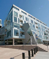
The project proposal is held in two stages within the expectations from the participants declared in competition specifications. First stage comprehending a transformation of the area where buildings determined as industrial heritage structures, are preserved through disposing cultural functions for highlighting the cultural and historical values of Arhusgade area. The second stage is predominantly contains housing,residential areas, service, retail and a wide re-creative area. In both first and second stages, the structures that are need to be preserved in terms of cultural and structural features will be used and the debris from the ones that are going to be salvaged material will be used for stuffing& blockage in the new structure. During the application of the whole process in a period of 50 years, qualifying and valuing the salvage and re-used materials will be increased in technological field.
The spatial quality of the whole competition site, some part of whose urban tissue is made up with industrial buildings have been determined as the two forthcoming facts that characterize the urban structure of the site. In this sense, the relationship of the site and the sea, and the change and expansion of it within the direction of the traces of the movement connected to this relationship, overlaps with the base of the project’s approach that consists of the sustainability concept.
Fact1: Topo(s)ustain: A Sustainable Connection of Land and Sea: Nordhavnen The planary structure of the artifically formed Nordhavnen peninsula as an urban living unit that opens freely towards the horizon, consequent to its former function, has helped to determine the initiative concept of the design which particularly leans on ecological planning approach: TOPOS The idea of creation of a new TOPOS, in design of the settlement site by means of the artificial isometric curves in the elevation, free form of Copenhagen’s topography corresponds with the necessity of the urban space’s potential of giving an ecological sensibility to its users. Forming a relationship with the urban texture the proposed settlement has a morphology that unfolds with a dynamic and soft movement towards the sea-end limits of the city that gains a fractal structure starting from INNERNORDHAVNEN. With the help of acute and wide angles, this movement provides different affects within the urban texture as it changes the urban space into a surprising living area for its users. The aim in using fractal forms has not only been for the integrity of the design but also for the faster construction of the eco-system. In this respect the form has been moved towards the northern parts where the new filled lands exist, and the coastal morphology has been shaped within this concept. This morphology in a sense, can well be defined as a NEW TOPOS which has been formed by the OSCILLATING MOVEMENT created by the sea and the wind. This piece of urban space RECREATED as an INTERFACE within accurate physical separations (water and air), has a character that wraps around the spine of the ecological formation intended to be sustained.
FACT2- Ecotone: A Sustainable Gateway for the Future
The Green Spine, defined as the gateway of Artificial TOPOS, integrates with that fractal structure and germinates the Green Structure that is going to exist in this area in the future. The area is an encamping point on the migration road of the birds and shelters the lagoons where the green toads under protection continue to live. As such, ECO-APPROACH should be accepted as a universal approach, necessary for the natural lives of the fish, birds, toads, butterflies, insects, amphibians, water and land plants. This approach, by creating empathy with all the other living creatures in the area, will be effective in increasing the sustainability consciousness of the users. Therefore, in the design strategy developed for coastal zones and especially for this area, ECOTONE concept is important as it accentuates the union of the species for a sustainable ecological life between sea and land.
NATURARTIFICIAL CONTACT
The necessity of taking NATURARTIFICIAL approach, as a basis in all the design criteria related to the habitat and morphology of this area, is one of the fundamental principles of the project. In this sense, the green spine, as a naturartificial design criterion that provides the connection between the mainland and the watery areas, assists ecological sustainability by enforcing the ecological contacts. This green spine, as an umbilical cord between the past and the future, is one of the most important facts that keeps the relation with the city center both in perceptive and physical terms, as well as sustains this relationship while provides its diffusion in the area.
This spine’s edge point reaching the sea, in the period of staging until 2050, will be terminated with an energy tower and a marina that, beyond its symbolic character in the other eco cities, will be a real landmark, for Nordhavnen where new technologies will be used. This energy-tower, as it is a building having a symbolic value will carry a landmark characteristic not only for Nordhaven but also for Copenhagen, is planned to be the symbol of sustainable environment and ecological life conformation of settlement design. Especially, the building that is significative in defining the horizon line at the end of green spine, will help Copenhagen city to carry its memory to its future identity.
THE NET
Motorway for public transportation is moved to underground at the intersection point of Arhusgade, continues under Svanemollen towards the city centre and the railroad running underground between Svanemollen and Osterport train stations, actualizes the uninterrupted continuity of the green spine moving from the fractal coastline till Copenhagen city center. Through this effective decision, a cultural and a social bond with the center will be provided. Similarly, the motorway for private motor cars running towards the area will also be moved underground. A carpark for 20.000 cars is proposed. Carpark exits that will be placed in the residential and office spread points will be fed by the green spine. The main aim of the proposed transportation system is to compel the vehicles, consuming fosil fuel, underground. Ground level will be left only for the use of pedestrians, bicycle users, electrical & hybrid vehicles and monorail. Metro and all other vehicles will drive underground.
With the new water canals, it is aimed to protect the diversity of the existing sea-related functions (cruise port, marina, fishing port, water sports etc.), to enrich its bond with the area, to utilize the maritime transport possibilities and to associate the network in the green spine with the water. Parallel to the continuity of the movement of the texture, these canals, introduced between the threshold of Qruise Quay and Fiskerihavnen, provide the preservation of the existing canal structure that is a part of the morphological identity of the center of Copenhagen, by developing an alternative transportation of people and vehicles (water taxis, canal tour boats, excursion boats and other boats). Another important contribution of the canals is by maintaining the current water circulation in the area, to ensure good quality bathing water as well as facilitate new land reclamation, etc. in the future. Intercommunication defined on the Net directs the public flow to the urban function areas.


 cityup.org 传真电话:010-88585380